Pedestrians (Active Mobility)


Walking - the oldest mode of transportation - is how people move and is essential for access to local services and other modes of mobility, especially public transport. A walkable city has high quality (wide, clear, continuous) walkways/sidewalks, safe street crossing points, street furniture and landscaping, slowed motorised traffic and managed parking, prioritised access to public transport services and space for public life and community activity*.
* Source: Walking: Implementing the New Urban Agenda | SUTP | 2018
Pedestrian improvement measures comprise the following topics:
n
Pedestrian Networks
Pedestrian networks comprise all publicly accessible footways, footpaths, sidewalks, crossings, bridges, underpasses, open spaces and physically permeable buildings and structures where people are permitted to walk. Effective planning and design of pedestrian network should facilitate people’s ability and desire to access places by foot, while enabling social interactions. Planning and designing walkable pedestrian networks should focus on the needs of all pedestrians and to ensure the provision of a consistently high-quality walking environment:
n
Pedestrian Facilities
Pedestrian facilities are spaces and other elements specifically designed for walking. The selection and implementation of pedestrian facilities should be based on the needs of people of all ages and abilities. They comprise the following elements:
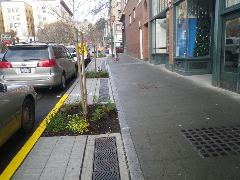
Footpaths and Sidewalks
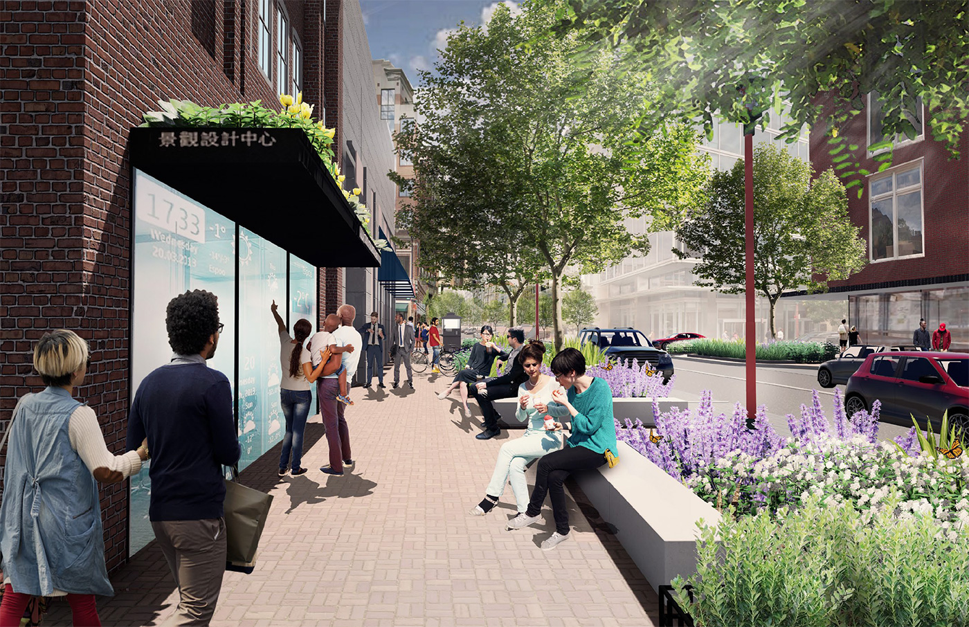
Footpaths and Sidewalks enhance connectivity and promote walking. As public spaces, sidewalks serve as the front steps to the city, activating streets socially and economically. They should be safe, accessible, and well-maintained. They should be continuous, provide a clear path, wide enough for pedestrian volumes, and at least wide enough to allow two people using wheelchairs to pass one another.
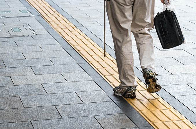
Guidance for the Visually Impaired
Provide accessible pedestrian signals at intersections, tactile paving strips on sidewalks, kerb edges and pedestrian ramps to facilitate accessibility for people with vision impairment. Japanese inventor Seiichi Miyake invented tactile surfaces for the blind in 1965, and they were officially introduced in Okayama City in March 1967.
Kerbs
Provide kerbs to create a structural edge between the sidewalk and adjacent cycle or travel lanes to discourage vehicles from entering or blocking pedestrian areas (and assist in channeling water). They should not be more than be 15 cm high and should incorporate ramps at pedestrian crossings to facilitate safe access.
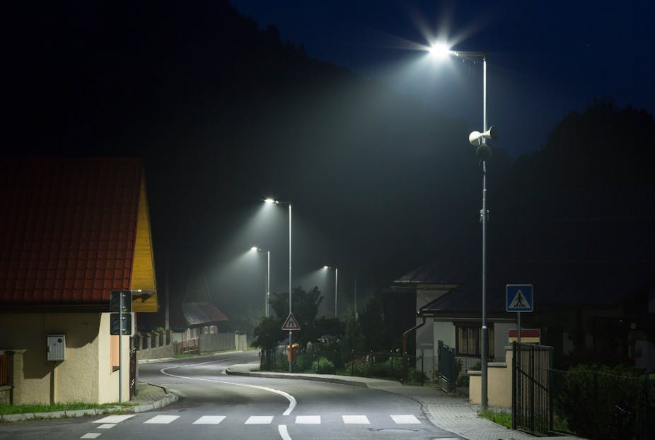
Lighting
Place pedestrian-scaled lighting along all streets, ensuring appropriate illumination levels and spacing to avoid dark spots between light sources to ensure pedestrian safety at night and preventing crime. LED lights are more energy efficient and they can be dimmed and switched off when there are no pedestrians about.
/https://www.thestar.com/content/dam/thestar/opinion/star-columnists/2019/03/13/torontos-pedestrian-countdown-signals-are-confusing-and-dangerous/crosswalk_jpg.jpg)
Pedestrian Countdown Signals
Install pedestrian countdown signals at intersections with crossing time duration displays with a numerical timer during the clearance interval. They should be clearly visible to the pedestrian at all times and should be equipped with audible signals that indicate when it is or is not appropriate to cross the street for pedestrians with visual impairments.
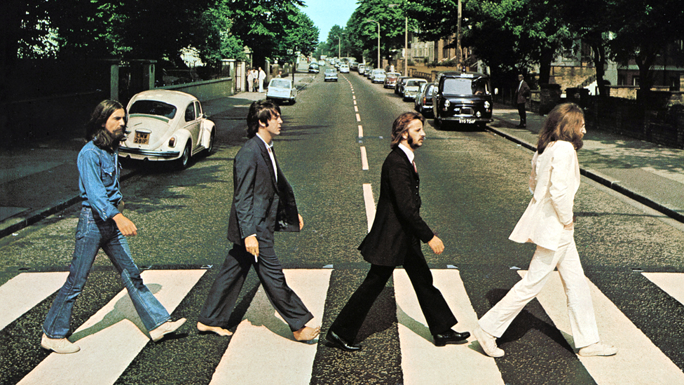
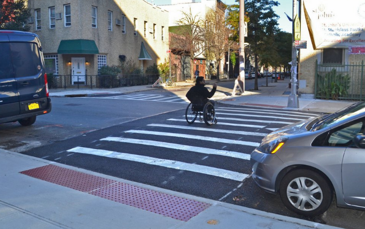
Pedestrian Crossings
Pedestrian crossings are usually denoted by zebra crossing stripes (some are painted with brightly coloured artistic designs and some use optical illusions to create in 3D slightly elevated zebra crossings). Zebra crossings are used both at intersections with lights and without lights. Pedestrians have the right-of-way at all such crossings which should be located at intersections and at mid-block points where pedestrian traffic is anticipated.
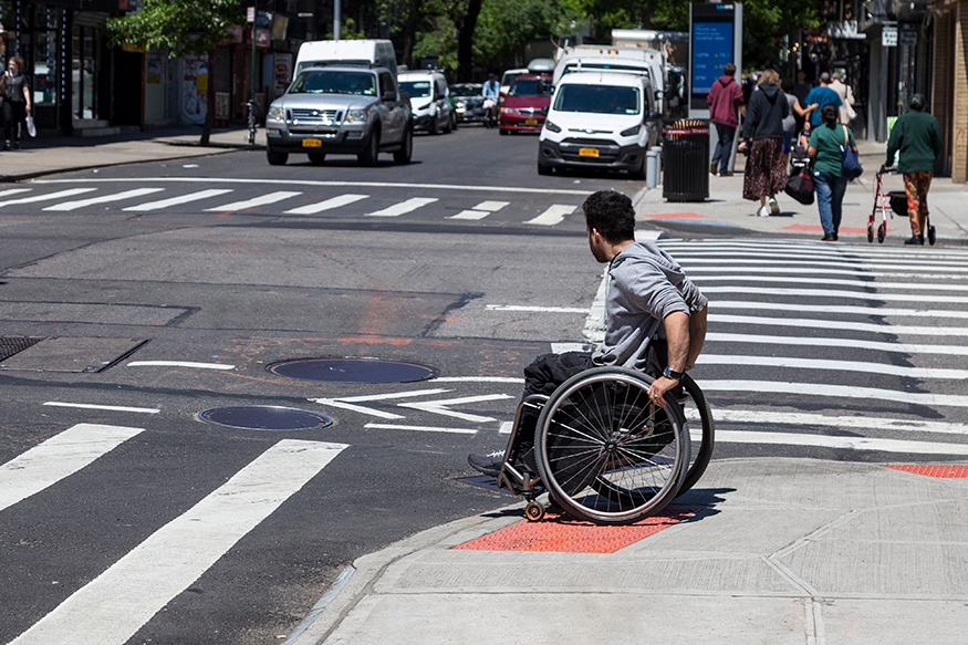
Pedestrian Ramps
These are required at every pedestrian crossing and change of level as they are essential for all pedestrians, especially children, the elderly and persons with disabilities. They should be built of non-slip materials and have a maximum slope of 1:10 (10%), ideally 1:12 (8%). Raised crossings, where provided, eliminate the need for kerb ramps while serving to reduce traffic speeds.
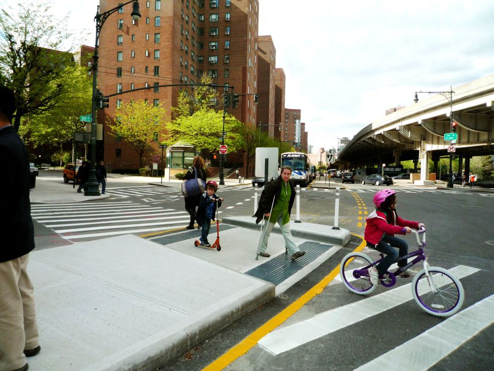
Pedestrian Refuge Islands
These allow pedestrians to stop in the centre of the road, so they can split the crossing into two stages for each direction of traffic. They are necessary where traffic speeds and vehicle volumes make single-stage crossings dangerous (usually in streets of with three or more lanes of traffic). They may also narrow the road, which reduces the speed of vehicles.

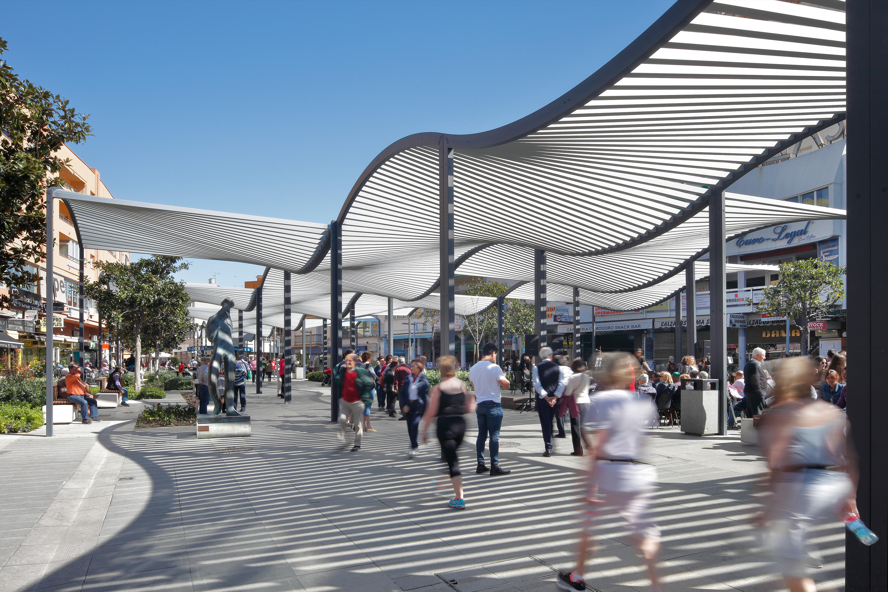
Pedestrian Zones
Pedestrian zones (also known as auto-free zones, car-free zones, pedestrian precincts and pedestrian malls) are areas reserved for pedestrian-only use and in which most or all traffic is prohibited. Pedestrian zones may also allow human-powered vehicles such as bicycles, inline skates, skateboards and kick scooters).
Raised Pedestrian Crossings
Raised Pedestrian Crossings improve accessibility by allowing pedestrians, wheelchairs and strollers to cross the street without the need for curb ramps. They also slow traffic as they serve as speed humps. Raised crosswalks are typically installed on 2-lane or 3-lane roads with speed limits of 30 mph (50 kph) or less and annual average daily traffic (AADT) below 9,000.
Seating
Provide frequent opportunities for people to pause and rest with seating that has comfortable backs, offering a mix of shaded and unshaded seats suited to the local climate. Large planters can also be used to provide seating and green infrastructure.

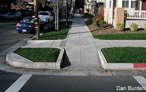
Sidewalk Extensions
Sidewalk extensions (also known as kern extensions) visually and physically narrow the roadway, creating safer and shorter crossings for pedestrians while increasing the available space for street furniture, benches, plantings, and street trees. They decrease the overall width of the roadway and can serve as a visual cue to drivers that they are entering a neighborhood street or area.

Signage and Wayfinding
These provide consistent pedestrian signage in a clear visual language that can be universally understood to navigate local street networks. Information should be understood quickly and easily, using universal symbols, internationally recognised pictograms, as well as tactile and Braille signage.

Trees and Landscaping
Include landscaping where possible to create a pleasant walking environment, contribute to the character of a neighborhood, encourage active transportation choices, improve microclimatic conditions, clean the air, filter water, and increase biodiversity. Select street trees and tree wells whose roots have a limited impact on the integrity of the sidewalk’s structure.

Waste Receptacles
Provide conveniently available receptacles for waste to help maintain a clean and enjoyable pedestrian environment near corners, street vendors, pedestrian crossings, and parklets. Waste receptacles should include recycling possibilities that offer pedestrians a convenient way to dispose of litter and recycling on the go.
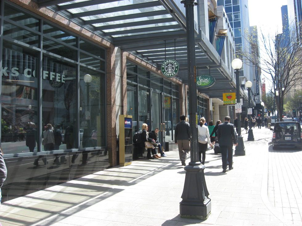
Weather Protection
Incorporate awnings and canopies into building facades and plant shade trees where possible along sidewalks and footpaths to add shelter and provide protection from the weather during snow, rain, or extreme heat.
n
Pedestrian Access and Mobility Plans (PAMP)

Pedestrian Access and Mobility Plans (PAMPs) have been developed in Australia to provide a framework for developing pedestrian routes and infrastructure to cater to the needs of all pedestrians, including older persons, people with mobility or vision impairments, school children, tourists, cyclists and recreational pedestrians. Similar to a Sustainable Urban Mobility Plan, it is a structured method to develop walking action plans.
n
Walkability
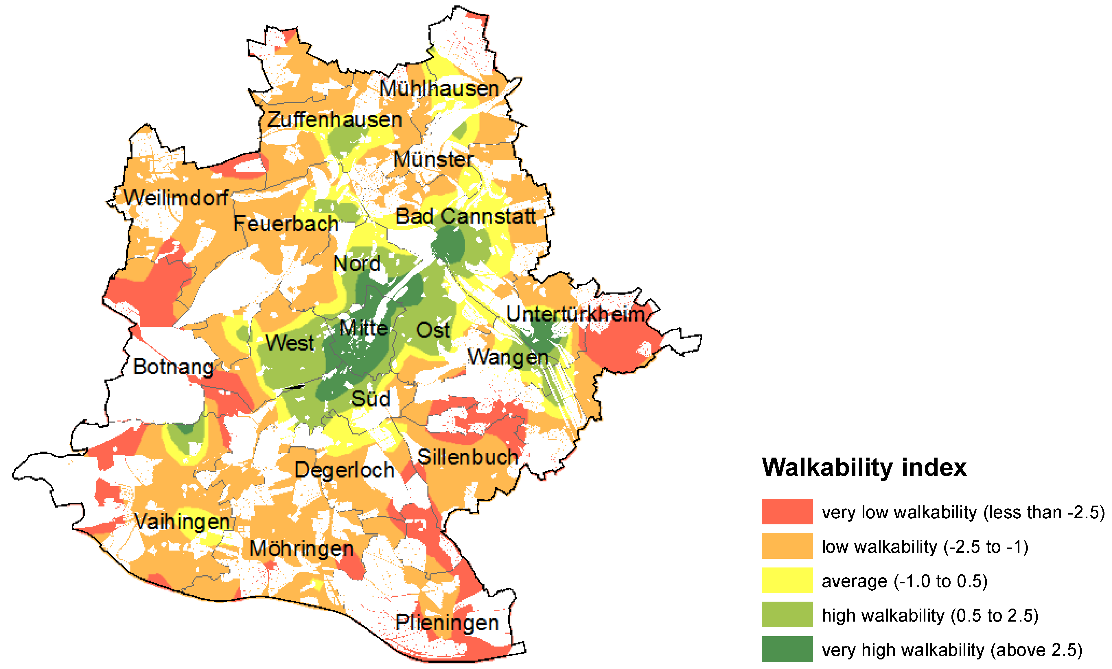
Walkability is the extent to which an urban area enables and encourages the movement of its citizens by walking. The concept of walkability also implies the provision of a “competitive advantage” to walking compared with using motorised vehicles. A walkability index score is used to assess the physical characteristics of the urban environment that support walking including residential density, sidewalk presence and completeness, land use mix, retail floor space ratio, and intersection density. A Global Walkability Index (developed by Holly Krambeck) ranks cities across the world based on the safety, security, and convenience of their pedestrian environments. ITPD has recently created a tool (Pedestrians First) that avoids indices, has a transparent methodology, and requires data inputs that are freely available worldwide. The metrics used are easily understood, applicable in a number of contexts, and represent a nuanced approach to understanding walkability in an urban environment.